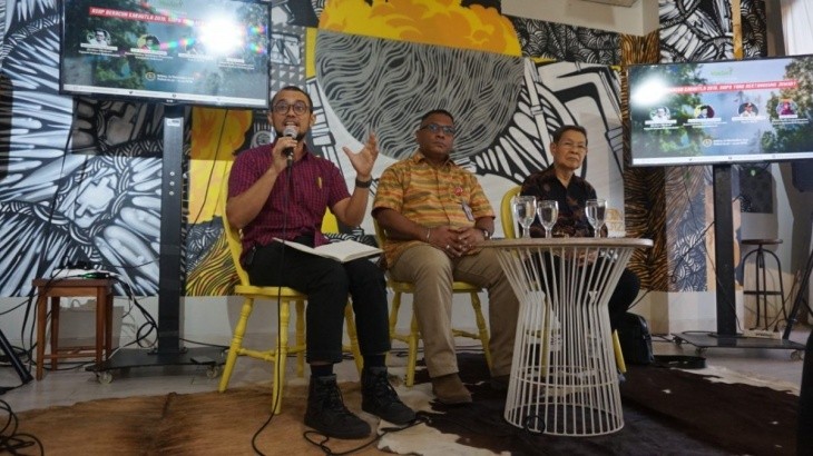
Jakarta, November 19, 2019. Amidst the ongoing forest and land fires (Karhutla), the government has a greater responsibility than simply extinguishing the fires, namely caring for residents affected by the smoke inhalation of toxic PM2.5 emissions from forest and land fires. Law enforcement should not only pursue the responsibility of land or concession owners, but also hold the victims of the toxic smoke accountable. The forest and land fires may have stopped for now (temporarily), but their impacts will continue for the next 20-30 years. This was stated by Muhammad Teguh Surya, Executive Director of the Madani Berkelanjutan Foundation, during the media discussion "Toxic Smoke from Forest and Land Fires 2019, Who is Responsible?" in Jakarta.
As of 2019, Madani identified hotspots in at least 836 oil palm plantations, 247 HTI concessions, 170 HPH concessions, and 111 PIAPS areas that had not yet been granted social forestry permits. Several companies experienced repeated fires from 2016 to 2019, as evidenced by the presence of burn marks. This indicates the need for a breakthrough to stop the haze disaster.
"It can be said that 1,253 companies are responsible for the toxic PM2.5 gas emissions during the 2019 forest and land fires," said Fadli, a GIS Specialist at Madani.
Madani and the Riau Advocacy Group (KAR) conducted a study specifically for Riau Province, which recorded the most hotspots during the January-August 2019 observation period, namely 13,656 hotspots. Based on an overlapping analysis of hotspot data released by LAPAN and VIRS in September 2019, it was found that the most hotspots in Riau Province were located in three regencies: Indragiri Hilir, Indragiri Hulu, and Rokan Hilir.
The large number of hotspots in Riau is extremely dangerous because much of Riau's territory is peatland. Madani's spatial study shows that the majority of hotspots in Riau occur in peat areas with a depth of 0.5 to 2 meters, or shallow to medium peat areas. Many hotspots in Riau also occur in priority peat restoration areas, with the majority occurring in protected zones. The total area of indicated fires in priority peat restoration areas in Riau reaches 49,117.9 hectares, with 16,467.2 hectares of priority peat restoration areas without canals (protected zones), approximately 16,027.9 hectares of peat domes (cultivated zones), approximately 7,866.7 hectares of canalized peat (protected zones), and 8,756.1 hectares of post-2017 fire areas.
From an investigation conducted in 14 villages in Riau, 11 villages experienced fires between April and September 20, 2019, including 7 villages that received the BRG peat restoration program, where 5 villages had experienced previous fires while 2 villages had never experienced fires before. The toxic PM2.5 smoke arising from forest and land fires has caused an increase in diseases suffered by the affected communities. Based on data from the Riau Provincial Health Office, the largest proportion of diseases caused by forest fires and the accompanying haze disaster from January 2014 to August 2019 were coughs, acute respiratory infections (ARI), pneumonia, skin infections, pulmonary tuberculosis and several other degenerative diseases. The number of ARI cases in Riau Province is the highest compared to other diseases and tends to increase every year. Meanwhile, in 2018, 31.4 percent of pneumonia cases among children under five in Indonesia were in Riau Province, with the largest number in Siak Regency (86.9 percent), followed by Pelalawan Regency (72.8 percent), Dumai City Regency (64.4 percent), and the Meranti Islands (59.6 percent).
The disruption to public health caused by forest and land fires, which produce toxic PM2.5 smoke, is the responsibility of landowners and concessions whose land is burned, as well as the government. Therefore, they must also be responsible for the victims of the smoke.
"Furthermore, mitigating forest and land fires and treating smoke victims must be a top government priority and integrated into regional and national development plans," added Teguh.
Therefore, the government must prepare infrastructure to handle victims of toxic smoke, both during disasters and in the long term, including mitigation measures. The government should also design a program to educate people about the dangers of smoke and a disaster response plan. Furthermore, affected areas are required to provide free healthcare facilities for victims, funded by the state budget (APBN/APBD). Finally, the government must accelerate and strengthen peatland restoration efforts post-2020, as well as conduct permit reviews and enforce environmental laws to eradicate forest and land fires from their roots, so that President Joko Widodo's goal of developing high-quality human resources can be realized.
***
Contacts:
Muhammad Teguh Surya, Direktur Eksekutif Yayasan Madani Berkelanjutan, 0819-1519-1979, teguh@arsip.madaniberkelanjutan.id
Fadli Ahmad Naufal, GIS Specialist Yayasan Madani Berkelanjutan, 0813-1916-1932, fadli@arsip.madaniberkelanjutan.id
Luluk Uliyah, Senior Strategic Communication Officer Yayasan Madani Berkelanjutan, 0815-1986-8887, luluk@arsip.madaniberkelanjutan.id
Paparan Dampak PM2.5 dan Asap.ppt
Siaran Pers
BNPB
Press Release
Media Briefing 19 November 2019 rev02.pdf