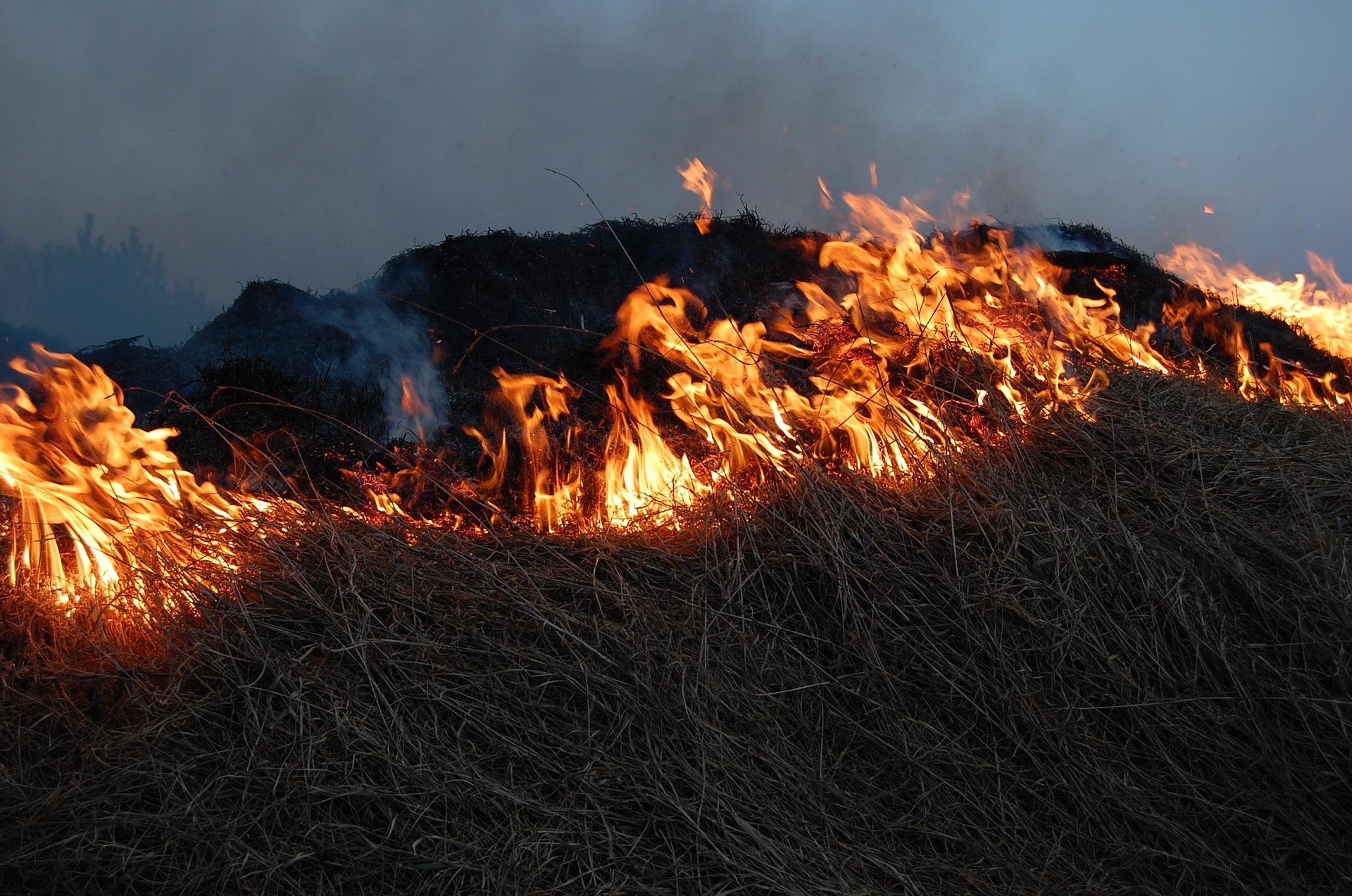
Stories of Vulnerable Groups from the Front Lines of Forest Fires: Women Bear a Double Burden, Persons with Disabilities Lack Evacuation Access, Indigenous Peoples Face Threats of Criminalization
Jakarta, September 10, 2026 — MADANI Berkelanjutan Foundation, together with the Indonesian Association of Women with Disabilities (HWDI) and the Indonesian Women’s Coalition (KPI), hosted an online public discussion today to address the impacts of the 2026 forest and land fire (karhutla) crisis on vulnerable groups. These groups are the most severely affected by fires yet their voices are rarely heard; bringing their experiences forward ensures they become an integral part of policy responses in fire management.
Based on MADANI Berkelanjutan's Indicative Burned Area (AIT) model analysis, total burned areas across Indonesia from January to August 2026 reached 1.32 million hectares, with the largest areas recorded in West Kalimantan (388,771 hectares), Central Kalimantan (245,102 hectares), and South Papua (149,076 hectares).
Nadia Hadad, Executive Director of MADANI Berkelanjutan, opened the discussion by emphasizing that conversations around forest fires have been overwhelmingly dominated by technical fire control aspects and burned area metrics, while the perspectives of vulnerable groups on the front lines have received disproportionately little space.
“Recurring forest and land fires are not merely natural disasters, but systemic failures. Vulnerable groups such as persons with disabilities, children, women including pregnant women the elderly, as well as Indigenous Peoples and local communities guarding the forests face multiplied risks,” Nadia stated.
Yuli Suryantika from KPI Pontianak Branch, West Kalimantan, highlighted the compounding burden placed on women: domestic and economic workloads are now heavier due to clearing ash, doing laundry more frequently, caring for sick family members, and purchasing face masks and medicine all while household incomes decline. Children also lose spaces to play and learn due to respiratory illnesses and disparities in accessing emergency online learning.
However, women are not merely victims. In Ketapang, more than 140 women across 10 villages actively participate in "The Power of Mama" initiative for fire patrols, prevention, and community education.
“Women, who are consistently on the front lines of impact, must also be granted a seat at the decision-making table,” Yuli emphasized.
Syarifah Nurul and Nia Kurniawati, Emerging Leaders from HWDI West Kalimantan, detailed the heightened health and economic vulnerabilities faced by persons with disabilities during haze crises.
Nurul, a Deaf individual from Pontianak City, West Kalimantan, explained that forest fires bring distinct threats to Deaf communities. When dense haze obscures visibility, they lose their primary "window" to perceive their surroundings a situation where hearing individuals can still rely on auditory cues.
“For us, our eyes are our window to see the world. When haze blocks our vision, we feel disoriented and isolated in silence,” Nurul shared.
The most critical hurdle remains safety information accessibility: early warnings and evacuation procedures have traditionally been broadcast solely via loudspeakers or TV broadcasts without scrolling text or Sign Language Interpreters. Consequently, Deaf individuals often remain unaware that danger is near, do not know where to evacuate, or struggle to communicate health distress caused by smoke inhalation.
Nurul stressed that disaster mitigation must be inclusive requiring visual early warning systems (such as flashing alert lights or emergency text messages) and disability-friendly health posts so that Deaf individuals are not "left behind in a silent haze."
Nia Kurniawati, a physical disability crutch user from HWDI Emerging Leaders in Bengkayang, West Kalimantan, noted that dense haze severely restricts her mobility, which depends on family assistance, while water sources dry up, schools close, and her canteen business comes to a standstill. Lacking government relief, she hopes for immediate access to clean water, mask distributions, and medical supplies for respiratory infections.
F. Deliana Winki, an Indigenous Dayak Simpang woman from Ketapang, West Kalimantan, explained the complex dimensions facing her community: ecosystem destruction from fires directly threatens their livelihoods, while customary land management practices which actively help prevent fires on the ground risk being misinterpreted, criminalized, and stripped of their socio-cultural context.
“Indigenous peoples want to be heard, involved in decision-making, included in fire management, and formally recognized and empowered through the passage of the Indigenous Peoples Bill,” Deli stated.
Pangarso Suryotomo, Director of Preparedness at the National Disaster Management Authority (BNPB), outlined strategies to address the specific needs of vulnerable groups: establishing smoke-free, disability-friendly safe zones/shelters accommodating children and pregnant women; protecting Indigenous Peoples' local wisdom from discrimination; and providing accessible evacuation routes and shelter facilities for individuals with physical and sensory disabilities.
Pangarso noted that BNPB already possesses policy frameworks for inclusive disaster management, including BNPB Regulation No. 14 of 2014 on the Handling, Protection, and Participation of Persons with Disabilities, and BNPB Regulation No. 2 of 2026 on Gender Mainstreaming. The key challenge lies in ensuring these policies are effectively implemented at regional levels. This encompasses establishing Disability Service Units (ULD), guaranteeing equitable evacuation access and disaster services in remote areas, and ensuring disaster responses do not lead to discrimination against Indigenous Peoples who play a vital role in safeguarding their environments.
Fadli Ahmad Naufal, GIS Specialist at MADANI Berkelanjutan, presented spatial data on forest fires and peatland conditions. Based on MADANI's AIT model monitoring from January 1 to August 31, 2026, over half of the indicative burned area (51.14%) was detected within permit and concession zones totaling 675 thousand hectares. The largest share was recorded within oil palm plantation permit zones (246,035 ha), followed by overlapping permit areas (166,208 ha), Forestry Business Utilization Licenses (PBPH) spanning 137,116 ha, oil and gas concessions (84,670 ha), and mineral and coal concessions (41,740 ha).
Syafiq Gumilang, Research Manager at Pantau Gambut, explained that the existence of the Peatland and Mangrove Restoration Agency (BRGM) reflected the necessity of dedicated institutions in overseeing peat restoration. Data indicates that declining peat fire trends coincided with active restoration programs led by BRGM, though other factors also contributed. Ironically, following BRGM's dissolution, the restoration mandate was transferred across various entities with increasingly limited authority, reduced budget support, and additional bureaucratic layers.
“More importantly, we need to re-examine the quality of past restoration efforts. From sample points of burned peatlands in restoration zones we observed, only about 1 percent regenerated back into forest. The remainder converted into oil palm plantations or monocultures, alongside several illegal oil palm plantations identified within Peatland Hydrological Areas (KHG). Thus, the issue is not merely who holds restoration authority, but whether restoration truly recovers the ecological function of peatlands. Without strong institutions, consistent oversight, and clear ecosystem recovery targets, peatland restoration risks becoming a technical routine without genuinely restoring peatlands as functioning ecosystems,” said Syafiq.
Viky Arthiando from the Center of Economic and Law Studies (CELIOS) detailed the economic losses caused by forest fires, including costs ultimately borne by the public. CELIOS recorded economic and health losses from January to August 2026 reaching IDR 39.29 to 123.1 trillion nearly half of Central Kalimantan's Gross Regional Domestic Product (GRDP) with 17.3 million people potentially affected by acute respiratory infections (ISPA) across 12 provinces in Kalimantan, Sumatra, Java, Maluku, Sulawesi, and Papua. CELIOS urged declaring a National Disaster status, evacuating vulnerable groups, evaluating plantation and mining permits, and forming an integrated ecosystem recovery team.
Recommendations
The discussion put forward three primary recommendations:
First, forest fire management policies must explicitly incorporate the needs of vulnerable groups, including accessible evacuation routes, targeted healthcare services, and social protection measures.
Second, the local knowledge and customary practices of Indigenous Peoples must be recognized and protected rather than subjected to threats of criminalization.
Third, the government needs to strengthen long-term fire prevention and preparedness, paying specific attention to protecting natural forests, peat ecosystems, and communities facing the highest risks. Organizers express hope that perspectives from vulnerable groups become central in designing a more just, inclusive, and sustainable fire response.
About the Organizers
MADANI Berkelanjutan Foundation: A non-profit organization accelerating just and sustainable climate action in Indonesia. MADANI executes four main programs: Climate and Ecosystems, Sustainable Agriculture, Community-Based Energy Transition, and Green Development, aiming to bridge field experiences with policy reform for sustainable climate justice in Indonesia.
Indonesian Association of Women with Disabilities (HWDI): A women’s rights organization led and driven by women with disabilities across physical, sensory, mental, and intellectual spectrums.
Indonesian Women’s Coalition (KPI): A women’s organization advocating for justice and democracy grounded in honesty, transparency, equality, sisterhood, freedom, independence, diversity, non-sectarianism, non-partisanship, non-violence, environmental awareness, and solidarity with marginalized groups.
About the Indicative Burned Area (AIT)
Indicative Burned Area (AIT): An early fire detection spatial modeling method based on high-confidence hotspots concentrated in specific zones after filtering out non-forest fire heat sources. Developed by MADANI Berkelanjutan since 2019 (with data updates up to H-3) to estimate fire extents in near real-time. The AIT model is validated using two approaches: Sentinel satellite imagery sampling and statistical validation against official SIPONGI data, yielding correlation coefficients above 90% and $R^2$ values above 80%, confirming that AIT distribution patterns closely align with official SIPONGI data.
Media Contact
Nur R. Fajar, Email: jay@madaniberkelanjutan.id
Access the presentation slides below: