
Dokumen Indonesia:
One Map Policy, Prevent Overlapping Land
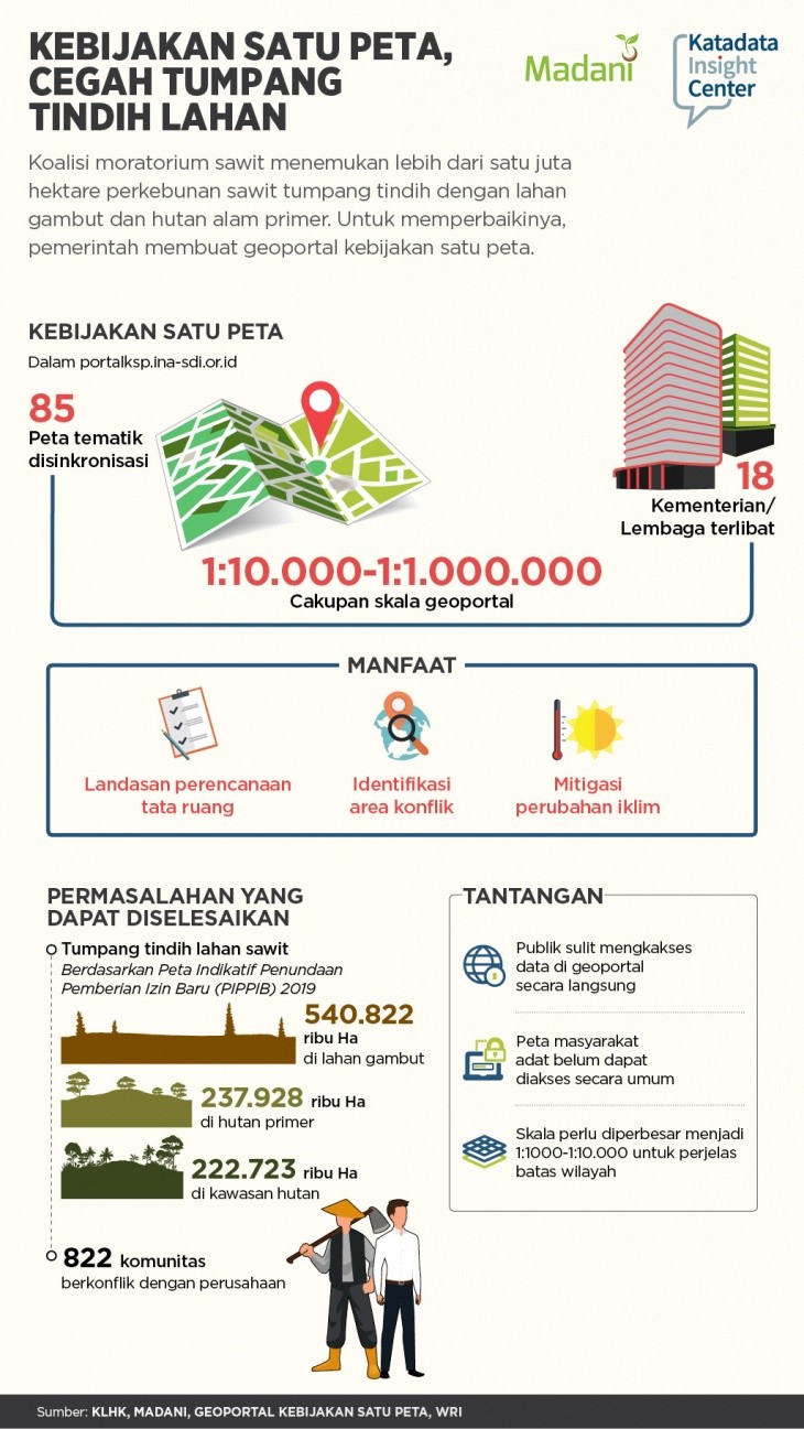
The palm oil moratorium coalition found more than a million hectares of oil palm plantations overlapping with peatlands and primary natural forests.
The palm oil moratorium coalition found more than a million hectares of oil palm plantations overlapping with peatlands and primary natural forests. To fix it, the government created a one-map policy geoportal.
The public can access it on the portalkp.ina-sdi.or.id page. The geoportal contains 85 thematic maps that have been synchronized with scales ranging from 1:10.00 to 1:1,000,000. The manufacture involved 18 ministries and agencies.
This one map is used as a foundation for spatial planning, identifying areas of conflict and climate change mitigation. Among them, overlap is more than 1 million hectares of oil palm plantation land with peatlands, primary forests and forest areas based on the Indicative Map of Delays for New Permits (PIPPIB) Revised V. Another issue, 822 conflicts between communities and plantations according to Sawit Watch records.
The geoportals that have been launched still need improvement. The public is still difficult to access data in geoportals directly. There is a procedure for submitting data to the relevant ministries / institutions to be able to access certain maps. The map scale also needs to be enlarged to 1:1000 to 1:10,000 to clarify the boundaries of the region.
This research is the result of the cooperation of the Sustainable Madani and Katadata Insight